
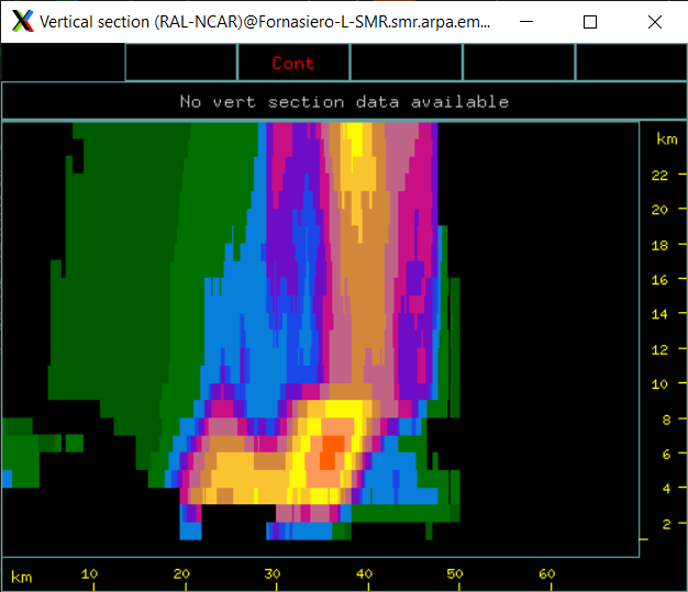
Hi, I used titan software to analyze the development of a multicell thunderstorm in Italy (Emilia Romagna) but I noticed exaggerated values of the top (maximum value 25 km). Do you have any suggestions as to where the problem might be? I suppose it could be a problem in the Radx2grid.params file, but I am not sure. I attach an image of a vertical section.
Very high top of thunderstorm
Hello @afornasiero
Can you please share your Radx2grid params file and radar specification especially at what height above the sea level the radar is installed
The radar is located at 40 m a.s.l. and the antenna is located at 25.39 meters above the ground.
Beam width is 0.9°
Frequency is 5.43-> 5.64 GHz
Coordinates are 44°47’29” North, 10°29’57”East
data range resolution is 250 m
here is the link to the params
file:https://drive.google.com/file/d/1z8uFuYNvbvSAT3nEL8qNhzzQ97gw1WRH/view?usp=drive_link
may I have a sample data in nc format to check
Hi, here you can find an example:
https://drive.google.com/drive/folders/10AQH433OncmLDY15JxCTKGytAoMDYk8o?usp=drive_link
Thank you
Anna